M7 Shared Path
The M7 Shared Path runs alongside the Westlink M7 Motorway and stretches for nearly 40 kilometres from Prestons to Baulkham Hills, connecting pedestrians and cyclists to Sydney’s Cycleways network.
Shared path benefits
Spanning 4-metres wide for most of the time, the M7 shared path provides the community with open space to enjoy an uninterrupted trip passing local creeks, access to bridge connections at the Western Sydney parklands, and links to local cycling networks, residential and employment precincts.
Shared path safety
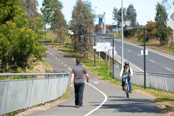
The M7 shared path is popular and is well-utilised by cyclists, runners, walkers, and the community. The path provides important leisure, recreational, transport, and health benefits. Westlink M7 has a range of safety initiatives to promote safe use of the path. For the safety of all users, the advisory speed limit is 30km/hr. It is also a legal requirement that dogs on the shared path be kept on lead.
Safety initiatives
M7 Shared Path light pole labels help responders in an emergency.
Westlink M7 has installed reflective night and day labels featuring an alpha-numeric code on all light poles along the M7 shared path. The labels are there to quickly help M7 Operations staff, shared path users, and emergency responders communicate location information when responding to an emergency on the path.
In an emergency, shared path users are encouraged to:
- look for the label on the nearest M7 shared path light pole
- use it a reference point when contacting Westlink M7, 24/7.
- when contacting emergency services, let them know you are on the “M7 shared path”
This community safety initiative has been developed in collaboration between Westlink M7 and NSW Local Government and Emergency Services stakeholders.
Shared path artworks
As part of the M7-M12 Integration project, the M7 Public Art Collection has also delivered rest stops, shared user path amenities and signage which have been artist designed and considered.
The shared path elements reflect the themes and narratives of the M7 Public Art Collection with interpretative elements that celebrate Aboriginal practices, such as weaving and carving, as well as wayfinding markers.
You can find out more about the M7 Art Collection and view the motorway art installations here:
www.westlinkm7.com.au/about/features-of-the-m7/public-art
Shared Path Map
View or download the M7 Shared Path Map which shows over 60 entry and exit points, as well as local attractions and nearby amenities.

Subscribe to M7 alerts, straight to your inbox
Keep up to date on news, events, and planned maintenance work on the M7 Shared Path subscribe to receive email alerts. Opt in or opt out at any time. View our Privacy Policy.
Contact us
See something that needs our attention? To report maintenance on the M7 shared path contact Westlink M7.